

Kwiatkowice - Rogów Legnicki - reconstruction of the floodbanks, commune Prochowice
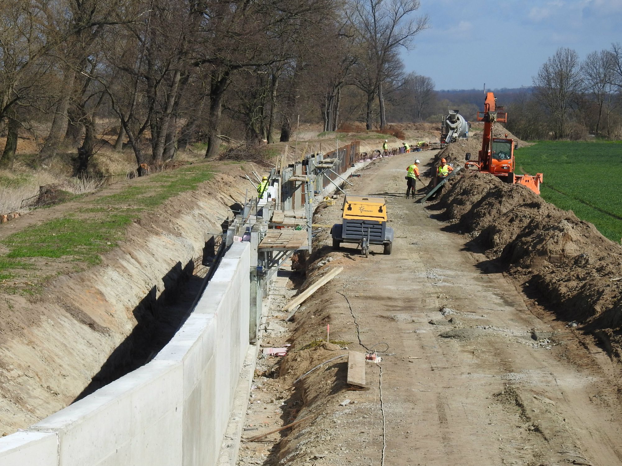
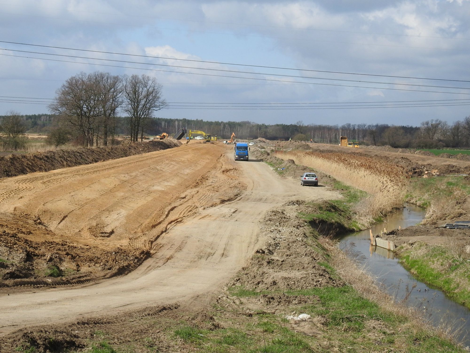
The subject of the project is flood protection of areas located in the valley of the Odra River at the level of Kawice, Kwiatkowice, Rogów Legnicki and Prochowice by building new sections of the Odra River embankments and extending the existing embankments of the Odra and Cicha Woda rivers. The total length of the embankment sections intended for extension, superstructure and construction is 13.136 km.
The project consists in the expansion, superstructure, construction and demolition of a total of 4 sections of the Odra and Cicha Woda embankments – voivodeship Lower Silesia, Legnica poviat, Prochowice commune, towns: Kawice, Rogów Legnicki, Kwiatkowice, Lisowice and Prochowice. The total length of the embankment sections planned for extension, superstructure and construction is 13.136 km, including: – construction of a new embankment – Malczyce – Kawice section, 2.030 km long, – extension, superstructure of the embankment – Kawice-Kwiatkowice section, 7.630 km long, – extension , superstructure of the left embankment of Cicha Woda, 1,881 km long (in Kawice), – extension, superstructure of the right embankment of Cicha Woda, 1,595 km long (in Kawice). It is expected to recover the natural floodplain on an area of approximately 74 ha, and to increase the valley retention by approximately 1.450 million. m3, as a result of the segmental demolition of the existing left-hand embankment of the Odra L-9 River and construction of a new Malczyce-Kawice embankment. The beneficiary of the project is the Lower Silesian Voivodeship (Dolnośląski Board of Melioration and Water Facilities in Wrocław). The investment will be implemented in the “build” formula on the basis of a permit for the investment. The contractor will be selected in a tender procedure in accordance with the PPL Act. The implementation will be based on the documentation and administrative decisions obtained and will be monitored by specialized technical staff. The most environmentally advantageous variant was selected, which combines flood protection and an increase in natural retention by approx. 1.450 million. m3 bypassing the protected celery meadows – constituting a fragment of the meadows marked in the plan of conservation tasks as natural habitat 6510 lowland and mountain fresh meadows extensively used.
The implementation of the project will increase the sense of security of the inhabitants of this area and will protect residential and farm buildings, arable lands, petrol stations, poultry farms and production plants against destruction.
Your project description
To add a photo, description, specify a location or attach other materials about the project, you should fill out the form below. After clicking the “send” button, a message will be sent to you e-mail asking for confirmation. You must accept to submit the form. The EU Dot Map Guidelines and consent to the processing of personal data. materials will be sent to the editor of the site, who will publish it on the website after verification test.